


drone detection
Drone Inspection
Solar panel inspections using drones not only dramatically increase efficiency,
but also overcome the limitations of traditional manual inspections:
A New Era of Smart Inspection:
Faster, More Accurate, and Safer Energy O&M
Rapid scanning, pinpoint accuracy, real-time decisions — intelligent inspection fully evolved

Rapid Large-Area Scanning
Automated flight paths cover vast areas in a short time, saving significant manpower and time costs.
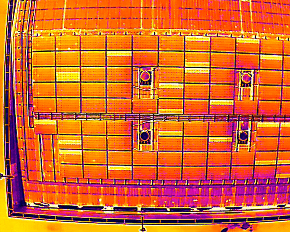
Thermal Analysis for Anomaly Detection
Integrated thermal imaging detects module overheating, panel damage, and cell aging in real time, reducing potential failure risks.
Real-Time Data Transmission
& Visualization
Inspection data syncs instantly to the platform, presenting anomaly locations and issue categories via images and reports for rapid decision-making.
Enhanced O&M Efficiency & Safety
Reduces exposure to extreme heat and high-altitude risks, improving inspector safety while accelerating maintenance response times.
Minimize Downtime Losses,
Maximize Power Yield
Early detection and rapid remediation help maintain stable plant generation, maximizing energy harvesting yield and ROI.
Boost Decision Efficiency
& Total Visibility
All inspection workflows are digitized, empowering decision-makers to assess system status instantly and plan effective O&M strategies.
Why Choose Us
Mapping & Surveying
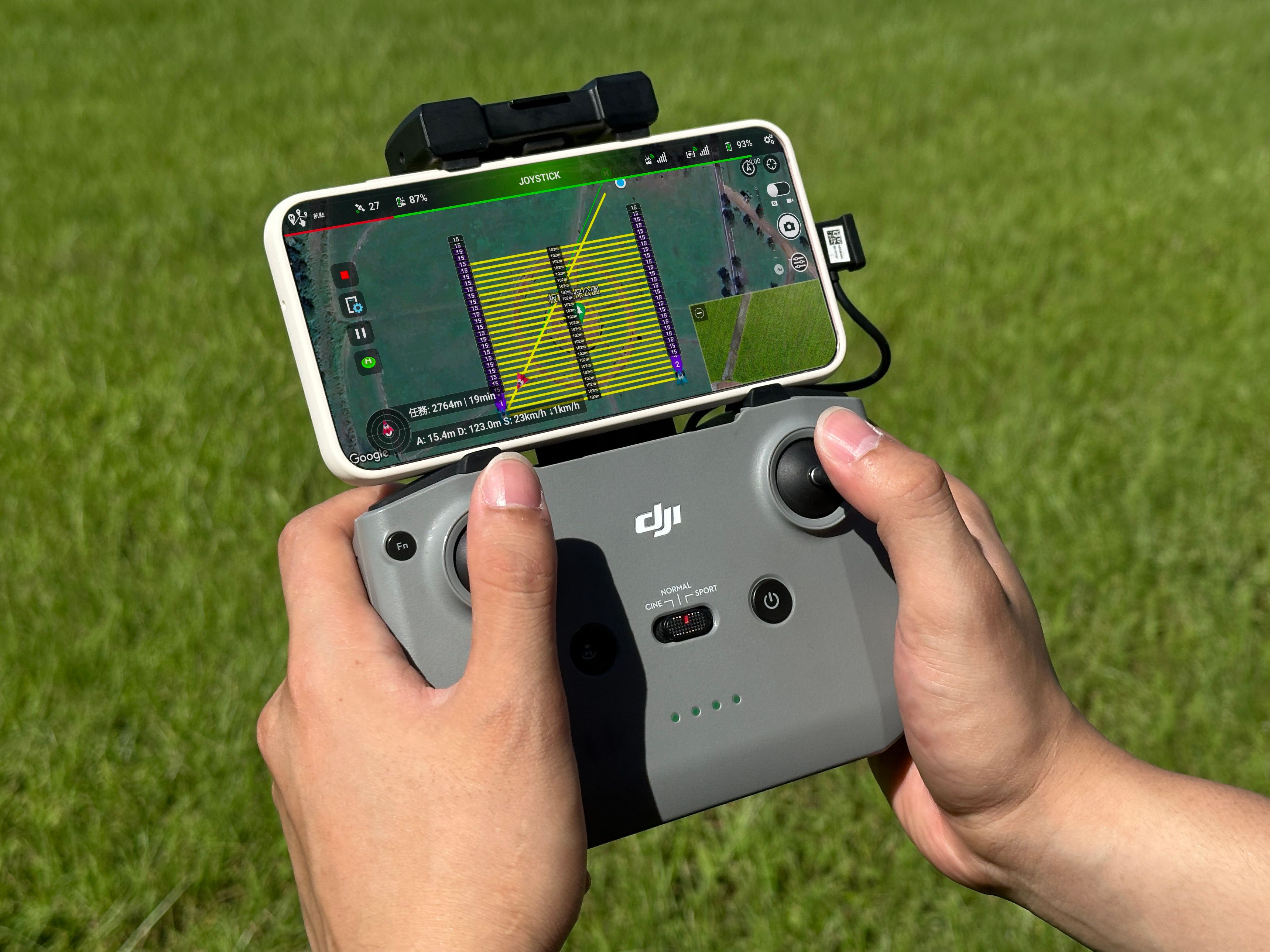
Precision Flight × Real-Time Data Control
High Efficiency Coverage
Ensures comprehensive inspection coverage, minimizing blind spots and overlapping paths.
Data Accuracy
Provides precise aerial imagery and flight paths, significantly increasing data collection accuracy.
Time Saving
Optimizes flight paths, shortens inspection time, and boosts productivity.
Smart Planning
Automatically generates flight routes to minimize manual operations and errors.
Flexible Adjustment
Mission areas and waypoints can be configured flexibly to adapt to various terrain requirements.
"Intelligent flight planning powers every mission.
From farmlands to urban areas, we help you gather
critical data rapidly and accurately."
- YY AI Solar Inspection & O&M Platform
"Track flight paths in real time, adapt flexibly to any site,
and complete solar inspection missions with confidence."
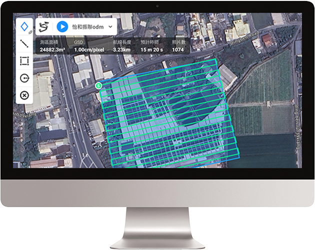
Intelligent Mapping Technology
HD Imagery Analysis
Generates detailed, high-precision orthomosaics for diverse spatial analysis and anomaly detection needs.
Anomaly Detection
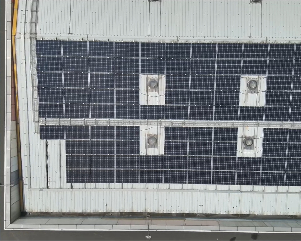
Rapidly identifies and tags abnormal regions from high-resolution imagery, boosting inspection efficiency and precision.
Comprehensive Coverage
Provides seamless, complete field image coverage, ensuring no potential issues are overlooked.
Reporting & History
Automatically generates maps and reports for warranty claims, historical comparison, and future maintenance reference.
Start Your New Era of Smart Inspection
From precision surveying to anomaly analysis, our AI and drone system turns inspections into digitized, actionable, and real-time insights. Making every inspection not just a record, but the starting point for optimizing energy efficiency and O&M strategies.
YY AI Drone Inspection・Smart Energy O&M